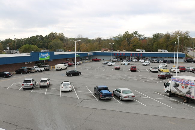
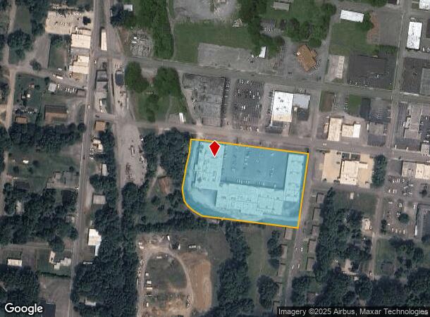
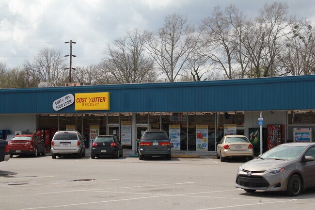
Property Record
319 W Patterson Rd, La Fayette, GA 30728
NEARBY LISTINGS FOR SALE OR LEASE
Property Detail
319 W Patterson Rd
1038-095
Battlebluff
Commercialnec
PT LL 46 7/4
AE
Walker
13295C0183D
Georgia
2024
4.20 AC
2024
Walker County
020602
Chattanooga
13,355 SF
Chattanooga, TN-GA
DEMOGRAPHICS near 319 W Patterson Rd
1 Mile
3 Mile
5 Mile
2024 Total Population
4,531
10,427
14,999
2029 Population
4,784
10,941
15,692
Pop Growth 2024-2029
+ 5.58%
+ 4.93%
+ 4.62%
Average Age
39
41
41
2024 Total Households
1,815
4,144
5,824
HH Growth 2024-2029
+ 5.51%
+ 4.92%
+ 4.64%
Median Household Inc
$32,787
$35,739
$39,633
Avg Household Size
2.30
2.40
2.50
2024 Avg HH Vehicles
2.00
2.00
2.00
Median Home Value
$94,370
$114,637
$129,291
Median Year Built
1970
1976
1978
Nearby Places
Map Layers
Map Styles
 Street
 Aerial
- Restaurants
- Banks
- Shops
- Fitness
- Groceries
PUBLIC TRANSPORTATION
AIRPORT
Lovell Field
DRIVE
WALK
Distance
Lovell Field
47 min
27.3 mi
Freight Ports
Georgia Ports - Savannah
DRIVE
WALK
Distance
Georgia Ports - Savannah
402 min
348.6 mi
SALE & LEASE HISTORY
LISTING DATE
SALE/LEASE

Oct 08, 2020
For Lease
Feb 26, 2019
For Sale
Feb 09, 2017
For Lease
Apr 27, 2020
For Sale
Apr 17, 2018
For Sale
Nearby Properties
Address
Land Use
TOTAL SIZE
Lot Size
Zoning
Address
Land Use
TOTAL SIZE
Lot Size
Zoning
879,640 SF
R2
Address
Land Use
TOTAL SIZE
Lot Size
Zoning
161,820 SF
21.25 AC
R1
Address
Land Use
TOTAL SIZE
Lot Size
Zoning
149,023 SF
18.68 AC
B2
Address
Land Use
TOTAL SIZE
Lot Size
Zoning
75,043 SF
11.48 AC
R2
Address
Land Use
TOTAL SIZE
Lot Size
Zoning
1,050 SF
162.24 AC
I2
Address
Land Use
TOTAL SIZE
Lot Size
Zoning
113,243 SF
13.53 AC
I2
Address
Land Use
TOTAL SIZE
Lot Size
Zoning
68,658 SF
13.61 AC
R1
Address
Land Use
TOTAL SIZE
Lot Size
Zoning
20,640 SF
1.27 AC
B2
Address
Land Use
TOTAL SIZE
Lot Size
Zoning
246,362 SF
13.60 AC
I
Address
Land Use
TOTAL SIZE
Lot Size
Zoning
75,000 SF
13.22 AC
I2
Address
Land Use
TOTAL SIZE
Lot Size
Zoning
5,406 SF
4.32 AC
B2
Address
Land Use
TOTAL SIZE
Lot Size
Zoning
122.85 AC
I2
Address
Land Use
TOTAL SIZE
Lot Size
Zoning
100,370 SF
4 AC
B2
Address
Land Use
TOTAL SIZE
Lot Size
Zoning
18 AC
R2
Address
Land Use
TOTAL SIZE
Lot Size
Zoning
47,556 SF
16.22 AC
I
Address
Land Use
TOTAL SIZE
Lot Size
Zoning
71,920 SF
9.69 AC
I2
Address
Land Use
TOTAL SIZE
Lot Size
Zoning
27,453 SF
16.38 AC
R3
Address
Land Use
TOTAL SIZE
Lot Size
Zoning
108,124 SF
28.27 AC
I2
Address
Land Use
TOTAL SIZE
Lot Size
Zoning
9,113 SF
6.57 AC
R3
Address
Land Use
TOTAL SIZE
Lot Size
Zoning
38,686 SF
6.86 AC
R2
Address
Land Use
TOTAL SIZE
Lot Size
Zoning
75,200 SF
12.12 AC
I2
Address
Land Use
TOTAL SIZE
Lot Size
Zoning
1,768 SF
6.52 AC
B2
Address
Land Use
TOTAL SIZE
Lot Size
Zoning
73,601 SF
29 AC
R1
Address
Land Use
TOTAL SIZE
Lot Size
Zoning
12,060 SF
8.45 AC
B2
Address
Land Use
TOTAL SIZE
Lot Size
Zoning
151,784 SF
41.50 AC
I2
Address
Land Use
TOTAL SIZE
Lot Size
Zoning
46,452 SF
1.38 AC
I1
Address
Land Use
TOTAL SIZE
Lot Size
Zoning
48,380 SF
8.29 AC
I
Address
Land Use
TOTAL SIZE
Lot Size
Zoning
41,176 SF
9.22 AC
B2
Address
Land Use
TOTAL SIZE
Lot Size
Zoning
41,620 SF
4.40 AC
B2
Address
Land Use
TOTAL SIZE
Lot Size
Zoning
0.66 AC
B2
The World's #1 Commercial Real Estate Marketplace
Connect with us
© 2026 CoStar Group
The information above has been obtained from sources believed reliable. While we do not doubt its accuracy we have not verified it and make no guarantee, warranty or representation about it. It is your responsibility to independently confirm its accuracy and completeness. Any projections, opinions, assumptions, or estimates used are for example only and do not represent the current or future performance of the property. The value of this transaction to you depends on tax and other factors which should be evaluated by your tax, financial, and legal advisors. You and your advisors should conduct a careful, independent investigation of the property to determine to your satisfaction the suitability of the property for your needs.